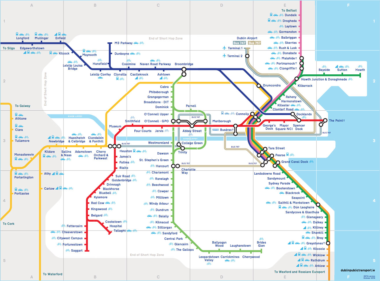
I’m really pleased to have soft-launched my latest design project, which is an independent online guide to Dublin public transport.
The guide, which is located at www.dublinpublictransport.ie, aims to provide a portal containing all the information you need to travel around Dublin by bus, train or tram.
A key part of the site is the new Dublin train map that I designed with the help of my good friend Richard Hart at Grey Dog Design. My aim with this was to provide a high-quality map that shows all Dublin train and tram lines in one place in an easy-to-understand format — one that wouldn’t be out of place in a major European capital.
A very important objective of the map design was to ensure it included easy-to-understand wheelchair accessibility information — the existing maps are poor in this regard. The map gives at-a-glance information regarding the suitability of stations for wheelchair users (and other individuals with a mobility impairment).
Additionally, the map provides clear information regarding which stations provide bike and car parking — again, something which is not really present on existing maps.
The Dublin Public Transport site also contains comprehensive information about
The site is currently in BETA format, so if you have any feedback on it, do let me know :)
